Official Newspaper of Eddy County since 1883
Official Newspaper of Eddy County since 1883
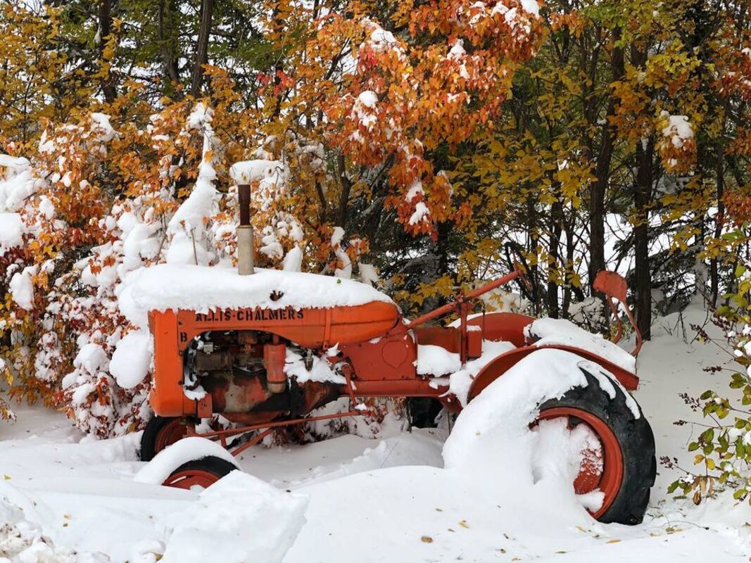
Photo courtesy of Cheri Schaffer
Blizzard conditions developed across portions of central and most of eastern North Dakota overnight Thursday, and continued Friday and Saturday as winds increased, gusting as high as 64 mph. This record-breaking October blizzard certainly left its mark by the time the storm finally began moving out of the area on Sunday. Total snow accumulations as high as 30 inches were observed near Harvey with drifts over 10 feet tall. Widespread snow amounts between one and two feet were observed across nearly all of central and eastern North Dakota. Travel became impossible across much of the area as the interstate and other local highways shut down. Some tree damage was observed across portions of eastern North Dakota, because trees had yet to drop all of their leaves and could not bear the weight of the heavy wet snow. The timing of this blizzard could not have been worse for the agricultural community, which needed a prolonged period of warm and dry weather for a harvest that was already delayed due to a record wet September. Do-it-Best shared this photo of downtown New Rockford on Saturday morning. If a person could make it downtown, they'd still have a difficult time getting into the door of any businesses.
Josolyn Collier, of Shear Delight hair salon, submitted this photo taken on Central Avenue in New Rockford on Saturday morning. Safe to say that the stylist opted to go back home rather than tunnel through the snow.
A "No Travel Advisory" was issued for most of eastern North Dakota by 7 a.m. Friday. Portions of I-94, I-29 and U.S. 2 were closed as of 10 a.m. on Friday due to severe winter conditions and zero visibility. Many roads in central North Dakota were closed or blocked as of noon Friday. The blizzard conditions were relatively short lived, however, as I-29 was open by 9 a.m. Saturday. Many other roads remained closed or blocked until late Saturday afternoon though. City streets were impassable even as of Sunday as crews worked to move the heavy, wet snow. Snow removal on city streets was not an easy task. In this photo taken by Colleen Hagen on Saturday afternoon around 2 p.m., only one lane was cleared on 13th Street. At that point only emergency routes were being opened. One city block in New Rockford was without power from 9 p.m. Friday to 4 p.m. Saturday. Several moments of flickering power were reported throughout New Rockford on Saturday morning. Other communities in North Dakota had short periods of power outage during the storm. Residents near Aneta reported power outage out from 1 p.m Friday to 6 p.m. Saturday.
Keeping cozy: While the storm delivered sustained winds of 40 to 50 mph, with gusts as high as 64 mph reported in Jamestown, the temperatures during and after the storm hovered in the high 20s and low 30s. The warm temps made for a relatively benign blizzard experience. By Saturday afternoon, kids – both young and old – had bundled up and ventured out into the snow. Below, Maddie and Anddie Schaefer of New Rockford tunneled into a large drift and made themselves cozy. Others reported staying inside and enjoying the idea of having nowhere to go. Across the region folks enjoyed home cooked meals, board games, handicrafts and the occasional nap.
Widespread impacts to ag expected: As local farmers are well aware, the storm made a bad situation worse. Heavy snow buried unharvested crops, which in many cases were either not mature or were on ground too wet to access. In addition, many livestock producers now face feedstock shortages, due to saturated hay and an early start to winter feeding. The photo above was submitted by Jean Schuster of New Rockford. The Schusters' cattle remained outdoors throughout the storm and were ready for fresh water and feed despite the ice crystals that had formed on their heads. Locally, NDSU Extension Service and the Eddy County Emergency Manager are seeking to quantify losses for aid. Eddy County NDSU Extension asks that ranchers send information such as livestock death losses, flooded pastures, feed loss and fencing damage. They note that pictures with descriptions are most effective, asking that producers "please picture the livestock how you found them and fences before you fix them." "It's critical for producers to share information with Extension so that we can assess the current condition across the state," said Doug Goehring, North Dakota Agriculture Commissioner. "Once that is determined, we will provide information to the Governor to assist in consideration for a Secretarial disaster declaration." Send information and/or pictures to [email protected] or through Facebook messenger to the NDSU Extension Eddy County Facebook page. Call the office at (701)-947-2454 with any questions or information. All are asked to state or note their name and location. Ranchers should be aware that livestock losses might be covered by the UDSA Farm Service Agency's Livestock Indemnity Program. For more information about the program and payment amounts, go to https://www.fsa.usda.gov/news-room/fact-sheets/index and download the fact sheet. A 'Notice of Loss' must be submitted to the county FSA office within 30 days of the apparent loss. Additional paperwork will be required at a later time. Producers are reminded to take pictures or have a third party (not a relative or employee) to verify death.
Truth: One notable October blizzard on record came exactly 60 years ago, in 1959. John Bollingberg of Bremen remembers the event quite well, as he and his wife Margaret were married Oct. 8, 1959 in Badger, Minn., Margaret's hometown. While the family was gone for the wedding, their cattle broke out of the pasture two miles from home in search of fresh water during the storm. In searching through Transcript archives, we found a story about the 1959 storm in the October 15, 1959 issue. That storm, it turns out, mirrors this year's snow event in many ways. The archived article stated that the 1959 storm started early on Thursday, Oct. 8 with rain and sleet. By that afternoon, six to eight inches of the white fluffy stuff had fallen on the prairie. On Saturday night a repeat performance brought another six inches of snow with 40-50 mph winds thrown in for good measure, stranding both motorists traveling and livestock still in their pastures. The differences between this storm and our recent snowfall are apparent as well. First, we got nearly twice as much snow this year, between 18 and 24 inches according to the National Weather Service. Second, 1959 was a very dry year in our area, whereas this fall has been severely wet, one of the wettest on record. Interestingly enough, residents of our area had a brown Christmas in 1959! Only time will tell what the rest of the fall will bring after this soaking wet September and ominously white October.
An early October blizzard brought much of North Dakota to a screeching halt last weekend. Light rains began as early as Wednesday, turning to snow by Thursday. Area schools released classes early and folks made that much needed trip to the grocery store. Then just when it seemed that the snow was letting up, winds came in full force, pushing the heavy white stuff into towering drifts. With roads impassable and activities cancelled, most folks opted to spend Friday and much of Saturday morning indoors. It was when folks ventured outside that they saw just how deep in snow they were buried.